Making Process for DIRECTION
PHOTOSHOP PART
For button 1
2. Create a new file with the width = 200 pixels, height = 60 pixels for my button
3. Paste the picture on the button file to act as a background and adjust the size
4. Use the Horizontal Type Tool to type “Way To Go” and set the type of design for the words.
5. Save the file in jpeg format
For button 2
*repeat the same step for public transportation and map
For decoration part
2. Draw the dog print by using the Custom Shape Tool and set the type of design for the dog print.
3. Save the file in “gif” format.
DREAMWEAVER PART
For main page
1. Insert the decoration picture at the side bar.
2. Type “Direction for Tree Top Walk” and set the design for the words.
3. Insert a table with 2 columns and 2 rows, merge the cells for the second row.
4. Edit the picture of “public transportation” and “map” by typing the words on the pictures
5. Insert the pictures of “way to go”, “public transportation” and “map” into the table
For “Way to Go” page
1. Insert a table with 1 column and 5 rows, set the table border to 0
2. Insert the decoration and buttons pictures into the table; make the rollover image effect for the buttons.
3. Insert the information about the Tree Top Walk and set the design for the words.
4. Insert a picture of Tree Top Walk after finish insert the information.
For “Public Transportation” page
2. Type the information for bus services and insert the table with 2 columns and 6 rows.
3. Insert the buses’ picture into the table and the bus name below the picture of buses.
4. Insert the information, links and picture about the Keretapi Tanah Melayu (KTM)
For “Map” page
2. Insert the picture of the maps and the description for those pictures.
Finally, links all the webpage.
Description of individual ideation
I’m designing the direction to get to Tree Top Walk, Kedah. I will show a few of bus companies that provide services to get to Kedah. The information is attracted and put into simpler yet detail manner so that readers do not get confused.
Objective of the link
My purpose of providing this link is to ease the readers to get the information that they need before they start their journey. In this page, I will provide the way and map to get there, the public transport that provide the services to Kedah to reduce the potential of getting lost.
Design of GUI
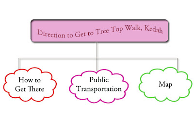
The picture above is my design of GUI. For the navigation bar, it will just same like the buttons in our blog, which contains introduction, accommodation, direction, people’s view, operating office hours & contact information and activities about Tree Top Walk, Kedah. For the button part, I will create 3 of it, which are How to get there, Public transportation and Map.
By clicking the button of How to get there”, it will show a very simple text form body content with few pictures.
By clicking the button of Public transportation, the content will include the bus companies that provide the services to Kedah and there will be a flash video for bus pictures.
By clicking the map button, you can find several types of maps to get to Tree Top Walk, Kedah.
Flow of chart

According to the flowchart, I will divide my direction link into 3 sections, which are How to get there, Public transportation and Map. I will use Adobe Photoshop in editing the pictures and map that I get from internet. Last but not least, Adobe Dreamweaver will be used to create my page and hyperlink all the links that I provided.
References
30 minutes drive from > Kulim Town
1 ½ hours drive from Penang/ Penang International Airport via Penang
Bridge > Butterworth-Kulim Expressway (BKE) > Kulim Hi-Tech Park > Karangan > Sedim;
3 hours drive from Alor Setar;
5 hours drive from Kuala Lumpur via PLUS Highway> Exit Bandar Baharu
Toll > Serdang > Kulim Hi-Tech Park > Karangan > Sedim OR;
5 hours drive from Kuala Lumpur via
PLUS Highway > Exit Juru Toll > Butterworth-Kulim Expressway (BKE) > Kulim
Hi-Tech Park > Karangan > Sedim.
BY ROAD
From Kuala Lumpur - a 5 hour drive takes you to Kulim, then proceed 30 kms
to Karangan/Sedim (Please look up for Hutan Lipur Sungai Sedim signboard).
From Penang / Alor Setar- please take the Butterworth-Kulim Expressway (BKE),
exit Kulim Hi-Tech Park, proceed about 30 kms to Karangan/Sedim
The below figures are shown that how to get to The Tree Top Walk.
Google Map
Map Satellite
Map to The Tree Top Walk
Map to Sungai Sedim Recreational Forest


No comments:
Post a Comment